Library - institutional publications
Károly Kocsis (Editor-in-Chief): National Atlas of Hungary Vol. 3 - Society (English edition)
| Editor - in - chief | Károly Kocsis |  |
|---|---|---|
| Title | National Atlas of Hungary Vol. 3 - Society | |
| Publication data | Budapest, CSFK Geographical Institute, 2021. 191 p. | |
| ISBN | 978-963-9545-64-9 | |
| Series | - | |
| Price | HUF 14.000 | |
| Weight | 2900 g | |
| Size | 42.5 x 31 cm |
The National Atlas of Hungary (MNA) was first published in 1967, and a second edition followed in 1989. Published in both Hungarian and English, this third edition of the National Atlas presents, in four volumes, the dynamic spatial structure of nature, society and the economy in Hungary and – wherever the required data are available – in the broader Carpatho–Pannonian Area. In the spirit of open access, the printed version is complemented by a complete, searchable version online (e-MNA at www.nationalatlas.hu).
A national atlas is the given country’s ‘identity card,’ one of its most significant national symbols in addition to its flag, coat of arms and national anthem. It is usually a series of maps complemented with textual explanations and various illustrations, which show the given state’s natural, economic and social features through logically and proportionally constructed maps using a well-defined scale and fairly uniform cartographic iconography.
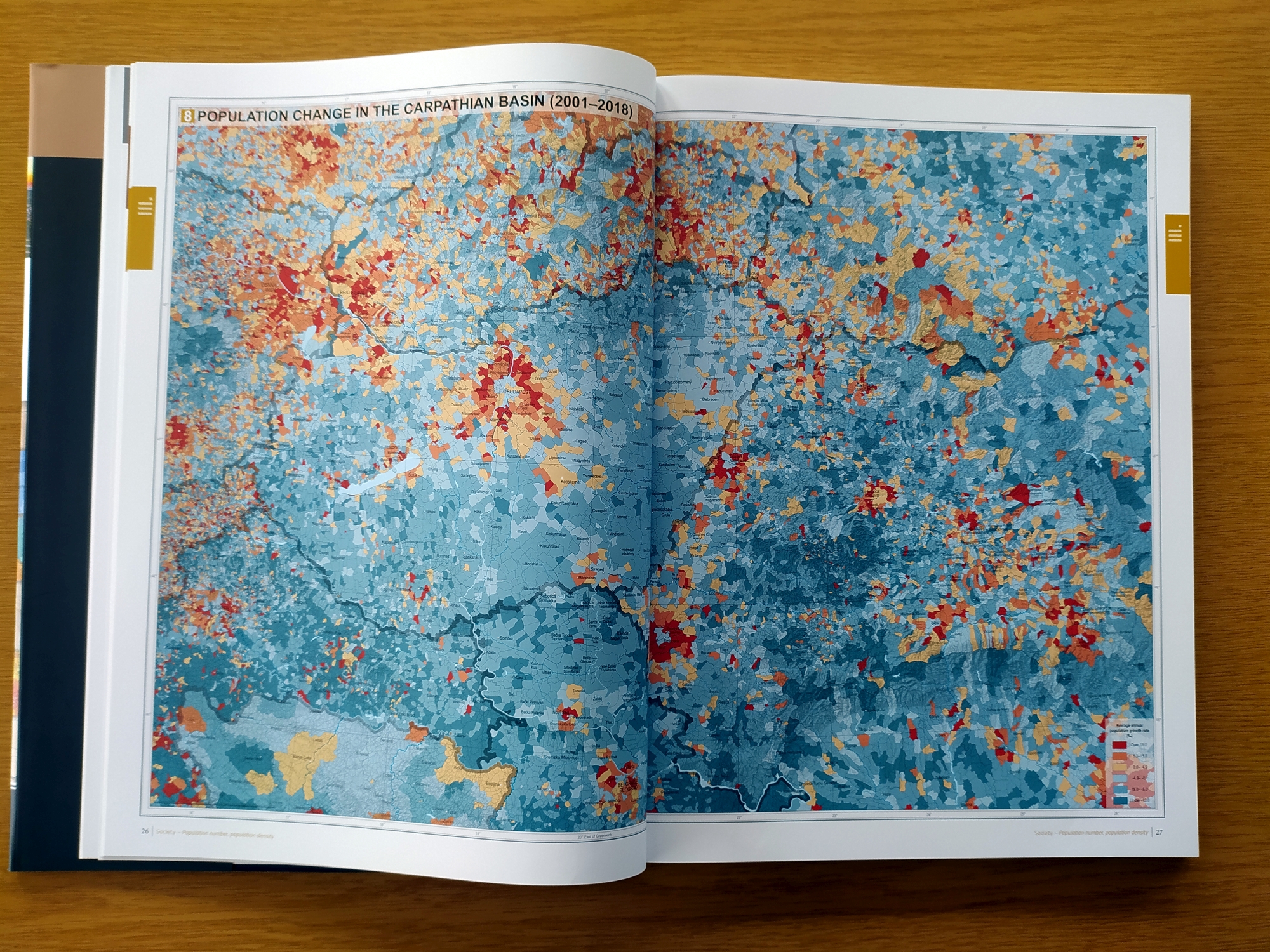
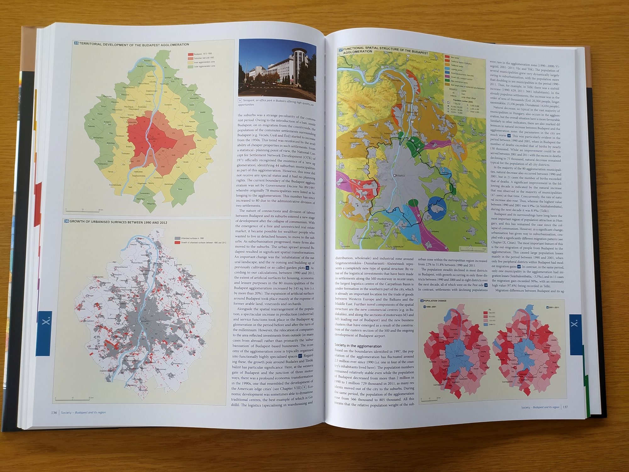
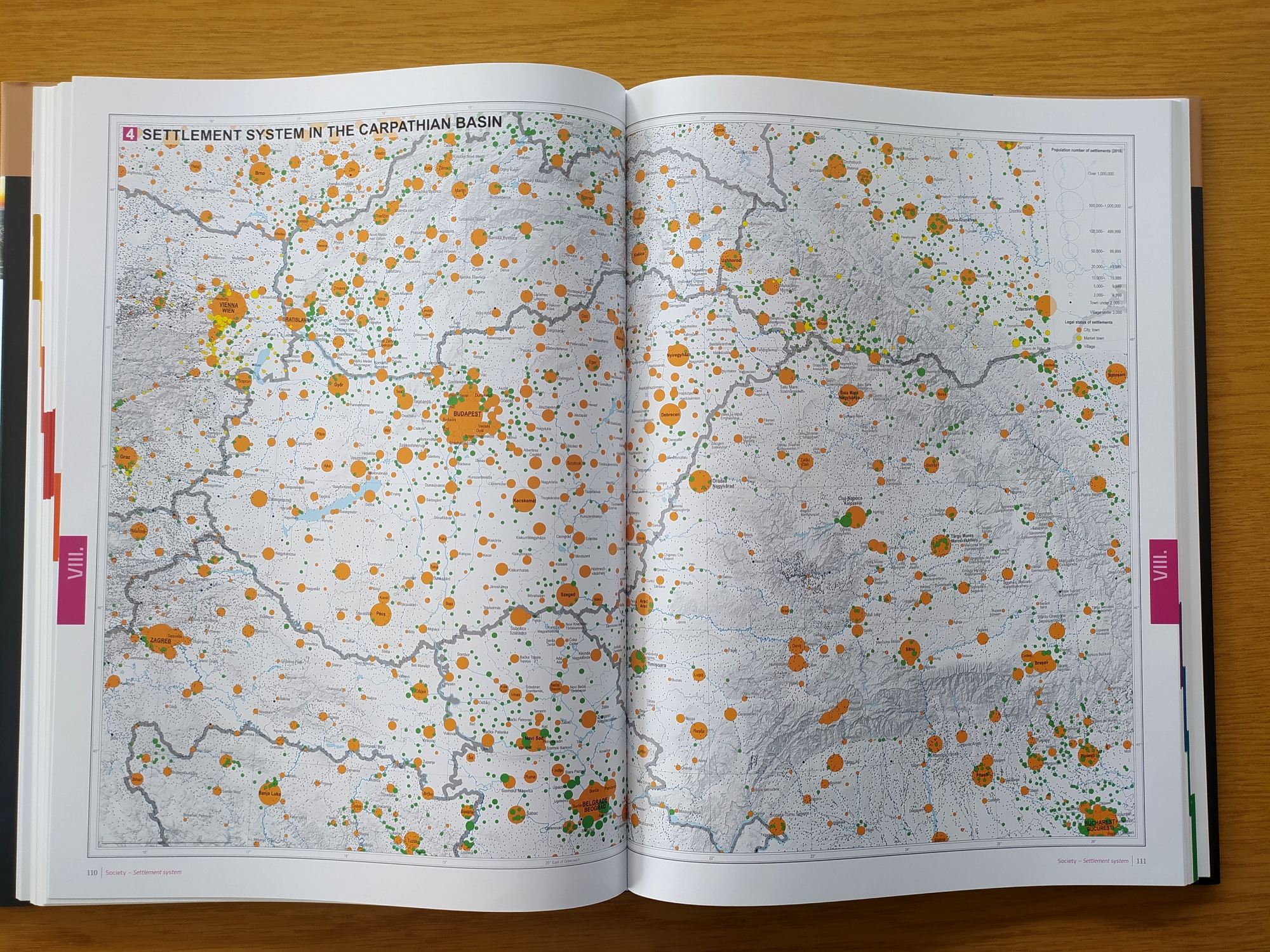
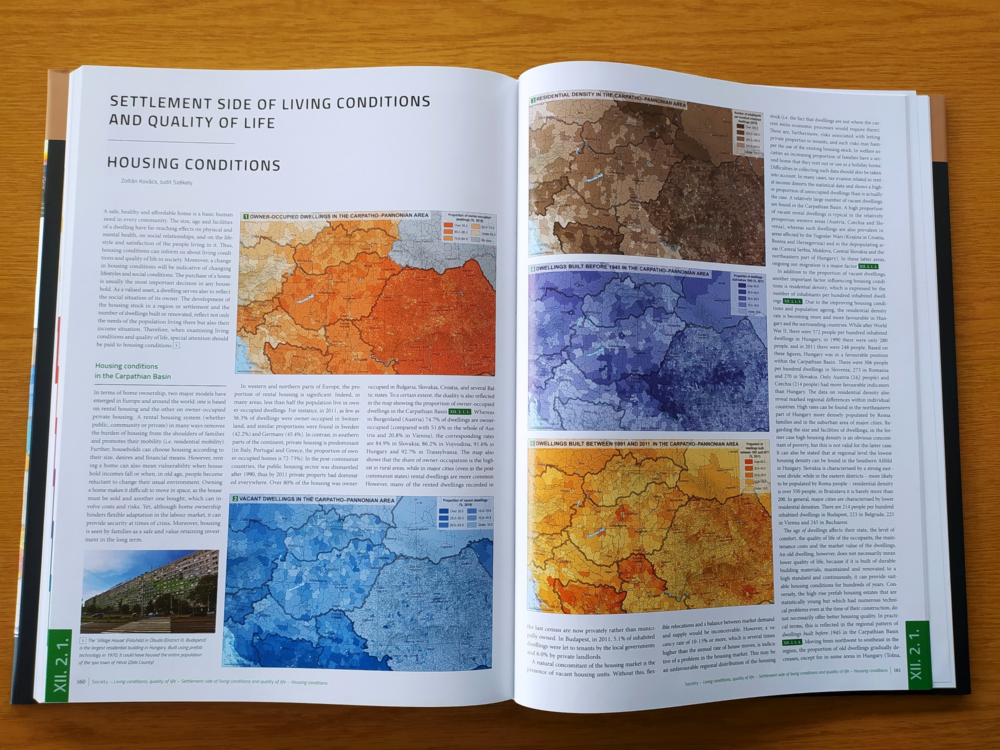
The Society volume of the new Hungarian National Atlas focuses on Hungary’s society, offering an overview of the spatial dynamics of the population and exploring historical roots. Several chapters analyse the interconnections and interactions between the human and natural environments (e.g. the human side of living conditions and quality of life, housing conditions and the municipal environment). The thematic maps inform about such diverse topics as fertility, live births out of wedlock, life expectancy, the main causes of death, resident foreigners, the cross-border migration of Hungarians, daily commuting abroad, ageing, marriage, divorce, cohabitation, ethno-linguistic structure, religiosity, educational level, unemployment, income inequalities, suburbanisation, the types and dynamics of urban and rural settlements, the changing face of Budapest and its agglomeration, hospital care, social welfare, the first year of Covid-19, inter-net use, housing conditions, the housing market, road accidents and crime.
On behalf of the several hundred contributors, we express hope that readers in Hungary and abroad will enjoy the pleasures and benefits of browsing the printed atlas or its online version. We trust that it will assist an understanding of society in Hungary and the Carpatho–Pannonian Area.

Please visit www.nationalatlas.hu to fulltext download.
Other publications


A magyarországi távközlés fejlődésének történeti térpályái
More information

